

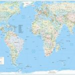
When we talk about international law, we talk about how the world is ruled. When doing so, we speak of States, territories and borders, often picturing them against a world map familiar from school geography lessons. Yet that apparently straightforward image embodies choices about how the world is represented.
The popular Greenland comparison makes the problem visible: on the commonly used Mercator maps, Greenland appears almost as large as Africa, although Africa is approximately fourteen times as large. A continent represented by 54 UN Member States appears comparable to Greenland, a self-governing part of the Kingdom of Denmark without independent statehood. As Luis Eslava discusses, familiar maps can reproduce inherited assumptions about whose place in the world matters.
To this end, on 4 September 2026, the General Assembly adopted the African-led “Correct the Map” initiative, presented by Togo, by 164 votes to one, with six abstentions: Estonia, Georgia, Lithuania, Moldova, Serbia and Ukraine (automatically generated UN transcript, 32:44).
This post argues that reforming the UN’s cartographic practice requires attention to both continental proportions and the legal positions maps communicate. It first clarifies what the Assembly endorsed, distinguishing the projection from territorial boundary drawing. Building on the ICJ’s map-relevant case law, it then examines the legal value attached to official maps and the implications of the resolution for implementation by the UN and its specialised agencies, particularly their obligations of non-recognition. Finally, it considers whether States’ statements and conduct with regard to the resolution could constitute opinio iuris about how official cartography ought to be conducted.
What the Assembly actually adopted
Equal Earth’s development was prompted by debate over Boston Public Schools’ 2017 decision to adopt the Gall-Peters projection, which preserves relative areas but markedly distorts continental shapes. Equal Earth’s designers sought to retain accurate area proportions while reducing those shape distortions. The General Assembly’s resolution promotes maps that make continental sizes easier to understand. It identifies Equal Earth as an option and encourages other equal-area methods where size comparisons matter (A/80/L.104, operative paras. 3 and 5; paragraph references below follow this text). Importantly, the resolution does not describe an exclusive projection or a definitive set of borders; no map is annexed.
On this point, the choice depends on what a map is for. On the one hand, Equal Earth preserves relative areas but distorts local shapes and angles (Šavrič, Patterson and Jenny). Mercator, on the other hand, preserves local angles and represents constant compass courses as straight lines, useful for navigation at sea. A classroom comparison of continents and a nautical chart therefore have different requirements. Hence, the resolution expressly preserves navigational uses (preamble, paragraph beginning “Recognizing that a variety of map projections”, p. 2).
Its practical programme concerns standards, education and cooperation with UN entities and digital platforms (operative paras. 6–12). Follow-up information and renewed Assembly consideration could sustain that work (paras. 16–17). This creates opportunities to change institutional practice without imposing a compulsory map on States or publishers.
When maps become legally relevant
Choosing a projection does not settle how borders or territorial status are depicted but simply translates the global shape of the earth into a flat image. On the other hand, the Equal Earth Wall Map project does not only offer a projection, but also illustrates these further choices involved. Its data notes describe Crimea in neutral grey, a de facto boundary in the Ilemi Triangle between Kenya and South Sudan, and de facto boundaries in Kashmir between China, India and Pakistan. Endorsing the projection, need not endorse those depictions.
In Frontier Dispute (Burkina Faso/Republic of Mali), the ICJ held that maps do not themselves constitute territorial title. Their evidentiary weight depends on their accuracy and provenance. They may acquire legal force by expressing the will of the States concerned, for example through incorporation into an official text (1986 Judgment, paras. 54–56).
In Temple of Preah Vihear, the parties’ acceptance of a map made its boundary line in the Temple area part of their agreed frontier settlement (2013 Judgment, para. 77, recalling the 1962 Judgment, see also here). In Pedra Branca, official Malayan and Malaysian maps labelling the island as Singapore’s supported an inference about Malaysia’s position on sovereignty. The Court considered them as evidence, distinguishing a boundary disclaimer from the question of sovereignty over a distinct island (2008 Judgment, paras. 267–272).
These cases concerned the conduct of particular States. UN publication alone does not establish every Member State’s acceptance. The EU’s explanation of vote in the context of Correct the Map Resolution expressly excluded endorsement of maps on external websites, including equal-earth.com. Ukraine, whilst abstaining to vote, still objected to depictions of occupied territory. Serbia abstained over associated political maps. India withheld endorsement of any particular projection, while the Philippines preserved its positions on maritime boundaries and jurisdiction (UN transcript, 24:18, 37:36 and 52:00–54:53).
Disagreement was also voiced with regards to the initiative’s justification. The US, casting the sole negative vote, associated it with a “much larger and more radical ideological project”, objecting to debate about maps and “their role in promoting reparations and cognitive justice”. The UK supported the resolution but rejected treating historical projections themselves as an injustice requiring UN redress (same transcript, 22:58 and 43:50). The large majority therefore did not imply agreement on every territorial depiction or on the rationale for reform.
How the UN depicts the world
The UN already uses several projections. The Secretariat’s cartographic FAQ lists Robinson, Winkel Tripel and Eckert IV without prescribing one. FAO’s fisheries mapping guidelines discuss Mollweide and Robinson. Implementing the resolution would involve reviewing varied practices, some already using equal-area projections.
Operative paragraph 7 invites UNESCO, UNDP, UN-GGIM, UNOOSA and other relevant entities to collaborate within their mandates. Assembly resolutions can have internal legal effects, depending on their terms and the powers exercised. The Charter gives the Assembly budgetary powers and allows it to entrust functions to the Secretary-General. Here, paragraph 16 requests information from the Secretary-General, while paragraph 7 invites cooperation. These provisions do not require universal replacement of existing maps.
Specialised agencies such as UNESCO and FAO are legally distinct organisations, connected to the UN through agreements under Charter Articles 57 and 63. Their publication policies are not automatically amended. For this, under Article IV(1)–(2) of the UN–UNESCO agreement, the UNESCO must for instance place formal recommendations addressed to it by the UN before its appropriate organ, consult upon request and report the outcome. Thus, there is a procedure for a follow-up, without requiring acceptance of a particular projection.
Existing UN positions on territorial status would remain relevant to such procedure. For example, Resolution 68/262, operative paragraph 6, calls on States, international organisations and specialised agencies not to recognise changes in the status of Crimea and Sevastopol based on the 2014 referendum, and to refrain from conduct interpretable as recognition.
In its 2024 Occupied Palestinian Territory Advisory Opinion, the ICJ concluded that international organisations, including the UN, must not recognise as legal the situation arising from Israel’s unlawful presence in that territory (paras. 279–280 and 285(8)). Whilst the Court did not address maps, the same reasoning could be applied mutatis mutandis: a map presenting an unlawful territorial acquisition as lawful could arguably engage an applicable duty of non-recognition. This would depend on the map’s labels, legend and context. Importantly, and in light of the case law above, depicting actual control does not necessarily recognise sovereignty, nor does every territorial dispute trigger that duty.
The scope for emerging opinio iuris
The implementation debate may also clarify how States understand the legal requirements of official cartography. In Nuclear Weapons, the ICJ famously recognised that non-binding General Assembly resolutions may evidence existing (customary) law or emerging opinio iuris. That assessment turns on their content, conditions of adoption and whether States accept them as expressing law (1996 Advisory Opinion, para. 70). Still, its discussion of “nascent” opinio iuris also cautions against equating developing conviction with established custom (para. 73).
Here, the clearest legal positions concern territorial integrity and non-recognition. Support for equal-area mapping on educational or political grounds does not establish a legal duty to use it. However, also more specific opinio iuris could emerge concerning how existing obligations apply to official cartography, including the distinction between de facto control and actual sovereignty. Such acceptance as law may be evidenced by States’ statements and conduct, assessed in context (ILC conclusions 9–10). Although the vote count alone probably cannot establish such a legal conviction, the reporting and reconsideration process incorporated in the resolution offers occasions for further clarification (operative paras. 16–17).
Implications for international law
The obvious conclusion to draw is that the initiative gives African States’ criticism a route into institutional practice. Support extended beyond Africa, with the EU and Canada, Australia and New Zealand emphasising the initiative’s educational objectives, while Paraguay expressly highlighted Latin America’s interest in accurate representation. The geographical concern also extends to tropical regions in Latin America and Asia, which Mercator depicts as relatively smaller alongside higher-latitude territories. These effects vary with distance from the equator, including within regions, so support for reform need not reflect an identical experience of cartographic distortion. For UN bodies and specialised agencies, implementation calls for choosing projections suited to their mandates and reviewing territorial depictions against applicable law. Giving reasons for those choices would make the legal positions communicated by official maps easier to identify and assess.
Beyond these potential legal implications, the initiative invites a broader reflection on how cartographic projections shape our understanding of the world: the classroom map with which we began becomes familiar through repetition. Changes to UN publications and educational guidance could help make Africa’s and other countries actual scale equally familiar. That consequence does not need a new legal rule. The practical task now is to improve how the UN presents the world while respecting existing obligations concerning territorial status. Whilst the world’s geography would remain the same, the institutional image through which international lawyers understand it could change.
Image credit: Equal Earth, “Greenwich Meridian (o), English 1 – Standard boundaries”